")
")
")
")
                          |
| Click to enlarge |
August 11, 2018 - Today's stage promises to be complex and long: the route of the tratturo is not clear in many places, in others it is covered by SS17, and finally, the OpenStreetMap maps in this area are incomplete... in short, a real puzzle.
In Isernia, it's market day and, since the day promises to be particularly hot, I take the opportunity to buy a couple of peaches. The usual scene occurs: the girl at the counter tries to convince me to buy at least one kilo since they are cheap, and I have to explain that carrying an extra kilo on my shoulders, given the kilometers I have to cover with a backpack that is already heavy, can be a problem. I don't see her very convinced: people who have never gone on long walks can't fully grasp the ongoing struggle to keep the backpack weight light. I invite her to lift it... I see that she understands.
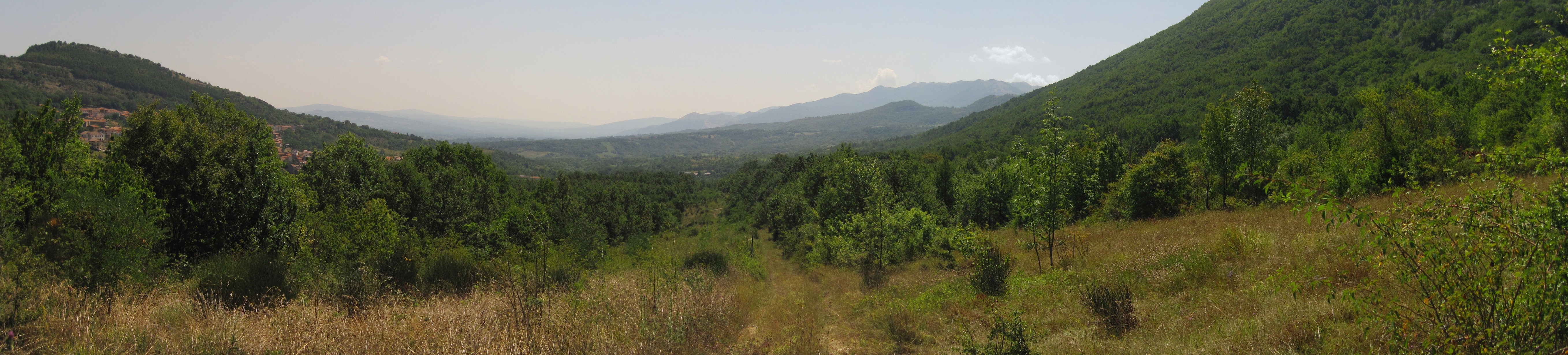
I set off. The tratturo did not enter the city, but passed north of it by a couple of kilometers, bypassing Colle dei Cerri and roughly following the current path of SS17. To shorten the stage a bit and to avoid asphalt, I make the decision to trek along the Sentiero Italia (SI) which runs nearby, and will lead me to Pettoranello del Molise, where I would join again the tratturo.
As I leave Isernia, the signs for the Sentiero Italia send me in the wrong direction, so I rely on the route I have prepared. I soon find myself immersed in the beautiful forest that covers Colle la Guardia. The initial dirt road continues on an easy path that ends in the small valley dominated by Pettoranello.
I continue to descend until my itinerary rejoins the tratturo, near to locality "la Taverna": the name is clearly a legacy of the time when sheep passed through these parts.
Satellite images and old maps seem to show the presence of two parallel branches of the tratturo that rejoin at the Valico di Castelpetroso. The first of the two is covered by SS17, so the choice falls on the second one, which has been used for the construction of a gas pipeline whose maintenance dirt road is in good condition.
Upon reaching the pass, I see among the trees the spires and the pinnacles of the Sanctuary of the Addolorata. It's a surprise: in preparing the route, I hadn't noticed its presence. Unfortunately, given the length of the stage, I don't have time for a detour: I will come back in the future.
Always on the mountain pass, a bar-restaurant offers me the opportunity to take a break and seek shelter from the sun. The owners are surprised to see me arrive with my large backpack, but after introductions, they are happy to chat with me. The first thing they say is that unlike the Abruzzese, the people of Molise do not know how to appreciate their beauties: no one knows anything about the Sanctuary, no one knows anything about the tratturo... I do not agree. As I said on other occasions, I have found the best-preserved stretches of the tratturo right here in Molise, and I have also seen initiatives to promote their enhancement. They don't seem convinced, but they confirm that the tratturo passed just above their restaurant. The direction is correct.
I set off again, and as I said, I find the first sign of a path towards Bojano that apparently coincides with the one I planned. The trail uses the gap between the trees created by a gas pipeline: it is not shown on the IGM maps and should, therefore, be recent. Most likely, the tratturo passed a little further north, passing through the towns of Pastena and Sant'Eramo.
The last section of the gas pipeline is covered in tall grass, but it is passable without major difficulty. Once I reach Indiprete, the gas pipeline track ends: I change direction, and an extensive cart track awaits me... which then narrows... which becomes a path... cluttered with plants... oh no, not thorns! Fortunately, the overgrown stretch is only a few dozen meters, so with a little patience, I manage to pass and emerge onto the old SS17 track.
A new turn to leave the asphalt... a new wide cart track... which then narrows... which becomes a path... I have a sense of déjà vu... which then becomes cluttered with plants... Actually, this time it goes better. After somehow crossing the bed of a dry stream, I emerge onto a cart track, and I'm done! From that point until Cantalupo del Sannio, it's a pleasant walk.
Fatigue begins to take hold, so the break at a village fountain lasts longer than usual. Bojano is still a long way off, but the idea that the tratturo should be in reasonable condition from Cantalupo to Candela and the fact that it avoids roads as much as possible uplifts my mood.
I take a cart track that soon widens, showing the tratturo exactly as the last shepherds must have seen it. The walk becomes relaxed, but just as I'm enjoying the pleasure of a shower, I encounter the last obstacle. I have to cross the completely dry Callora stream. It should not pose any particular problems, but during the winter, the stream must have a significant flow: it has excavated banks of about two meters, so I find it difficult to enter the bed, and due to the vegetation, I cannot find a point of ascent on the other side. I lose some time, but eventually, I find a way to get out of the predicament. I will later discover that if I had continued a little further along the stream's bed, I would have found a comfortable point of ascent.
I arrive at my destination exhausted but happy: despite the various obstacles, I managed to cover the stage, avoiding almost all the asphalted roads.
 |
 |
Track of the day