")
")
")
")
                         |
| Click to enlarge |
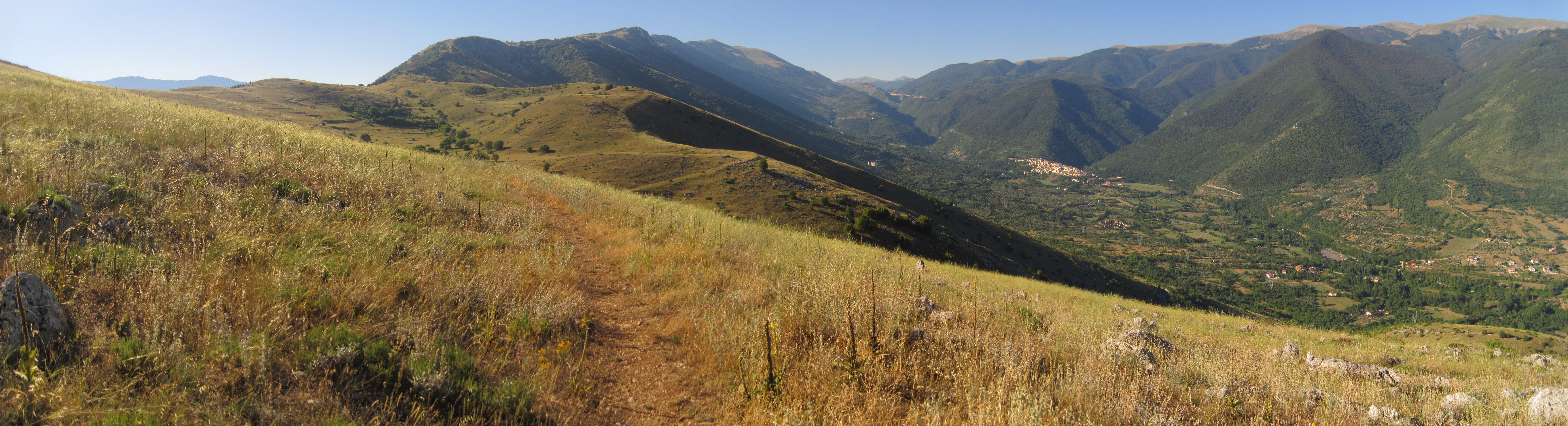
Third day: change of programme! When I told the manager of the B&B where I had slept about my plans, he suggested an alternative route. However, first things first! My initial idea was to spend half the day hiking on the Peligna valley floor, and to ascend towards the "Cinque Miglia" (Five mile) plateau in the afternoon. I would follow the Napoleonic Route, which was the one actually used by ancient shepherds. I would go through the villages of Pettorano sul Gizio and Rocca Pia, and finally reach the Cinque Miglia plateau. Instead, I was advised to follow the "Sentiero della Libertà" (Freedom Path), which runs parallel to the tratturo, but at a higher altitude. That path leads to the small village of Cansano. From there, one can reach the "Bosco di S. Antonio" (Saint Antony’s Wood), a scenic natural reserve, and then the Cinque Miglia plateau. The tourist information office in Sulmona recommended the same route, so my mind was easily made up. The area where I was to walk was not well covered by my GPS maps at the time (it is now), so I bought a topographic map for further support.
The "Sentiero della Liberta" begins on the side of the Sulmona cemetery and starts ascending right away. The rise is impressive: the view over the Peligna Valley is amazing and when temperatures started rising I was already on the hill crest. If I had followed the original plan, I would have spent the morning in the valley and would have started climbing in the hottest hours.
The descent towards Cansano begins just after the ridge. At the bottom of the hill I found a fork: a sign indicated Cansano on the left, where it is possible to continue along the SP55 road towards the Bosco di S. Antonio, another one on the right indicated a direct path towards the same woods. So the question was: right or left?
Right, obviously!! ... and for the first time I met the big obstacle which I was to fight against in the following days. The path is almost unused, so the grass and the wild bushes were so high that I felt like I was sinking into snow. Apart from fatigue, the risk was that the situation might even worsen, so much so as to make it impossible to carry on. The idea of tracing my steps backwards in the tall grass persuaded me to look for an alternative: as soon as the opportunity arose, I deviated towards the SP55 road, just above my path.
After a few kilometres, on a hairpin bend I found the only fountain of that day and the beginning of trail number 2. The words "non-drinkable water" did not seem to scare cyclists, who were stopping for a drink, so I took advantage of it too.
Path 2 runs in the woods. It is cool and the light filtering through the leaves really is appealing. I soon reached the plain of the "Bosco di S. Antonio". Many people were there those days to enjoy the coolness and have a picnic. I was Able to have a rest and a cold drink in a small bar. From there Path 1 leads to Pescocostanzo. Hikers who find it (I did not!!) and still have the energy (you must climb 200 meters) can avoid the asphalt, otherwise... SP55.
The asphalt stretch was boring, but it did give me the chance to make up for the time lost in the tall grass. After a few kilometres I reached Pescocostanzo, then, from Pescocostanzo to Rivisondoli the distance is very short.
I want to tell you about an episode which happened along the SP55 road: I bumped into an apparently stray Abruzzese shepherd-dog. Given the well-known aggressiveness of that breed, at first I was worried but then I noticed something I was to see several more times along the way. With no master or property to defend, it was intimidated by my presence and ran away. It was my first experience of this kind: I was relieved by the narrow escape, yet at the same time I felt sorry for the fate of such a beautiful creature.
 |
 |
Track of the day