")
")
")
")
                   |
| Click to enlarge |
Rivisondoli is only two kilometres from Roccaraso. From there the tratturo continues uphill towards Pietransieri on a track which is still clearly visible from the satellites but hard to walk along because of the vegetation. For this reason, I climbed the hill by following the SP84 road (Nuova Sangritana). Shortly before Pietransieri, I should have met the cattle track towards the Sangro river. Unfortunately, I did not have enough information about the starting point of the track in 2013. Neither did my GPS maps show any path in the area, and the satellite images were useless because they were not sufficiently detailed. So I decided to continue up to Pietransieri and ask for directions. With my great surprise, any memory on the tratturo was lost there: the young were not even aware that it ran close to the village, while the elderly vaguely remembered that I should have crossed the tratturo just before entering the village. Eventually, I did find someone who had a vague idea of the position of the tratturo, but did not recommend venturing because "... the foot of the hill is a maze of paths and it is easy to get lost or end up in cul-de-sacs with the risk of having to go back". I was advised to continue along the SP24 for a while and, by lengthening my route a little, come down the hill by following a dirt road running above a methane pipeline.
Having no alternative, I followed this advice. A few kilometres after the village, I found the path going downhill. The descent through the trees was pleasant. Along the way I came across some gravestones that reminded me of the fights which had taken place there during the Second World War.
Halfway down the slope towards the river, I met a forest ranger. A nice opportunity for a short break and a chat. The first question he asked me was: “Why are you going this way instead of following the tratturo?” I just didn’t know whether to laugh or cry!
After a short rest I moved on again. Everything went well for a while, then ... a dead end. Never mind, I could try a detour I had seen a little earlier ... another dead end... it was supposed to be the easiest way to the river! Fortunately, the GPS confirmed that the direction was more or less right and that I was slowly approaching the bottom of the valley.
Just as I was confident that all the problems were over, some barbed wire barred my way. No, that's enough, too late to go back! I threw my backpack over to the other side and crawled underneath. The effort was rewarded and the little abandoned station of Taverna appeared shortly after. It is located along the dismissed Sangritana Railway and, more importantly, it is close to the Sangro river.
Crossing the river was easy thanks to the presence of a footbridge: I left Abruzzo as I entered Molise. With the Sangro river behind me, it was once again time to climb a hill by following a convenient wide path. Surprisingly, I found some indications for the tratturo Celano-Foggia. It was the first time since the beginning of the journey and it became a constant feature. A few years earlier some European funds had been allocated to promote the tratturo: very good! From now on everything will be easier! Never was a prediction more wrong... but, wait, I do not want to anticipate anything.
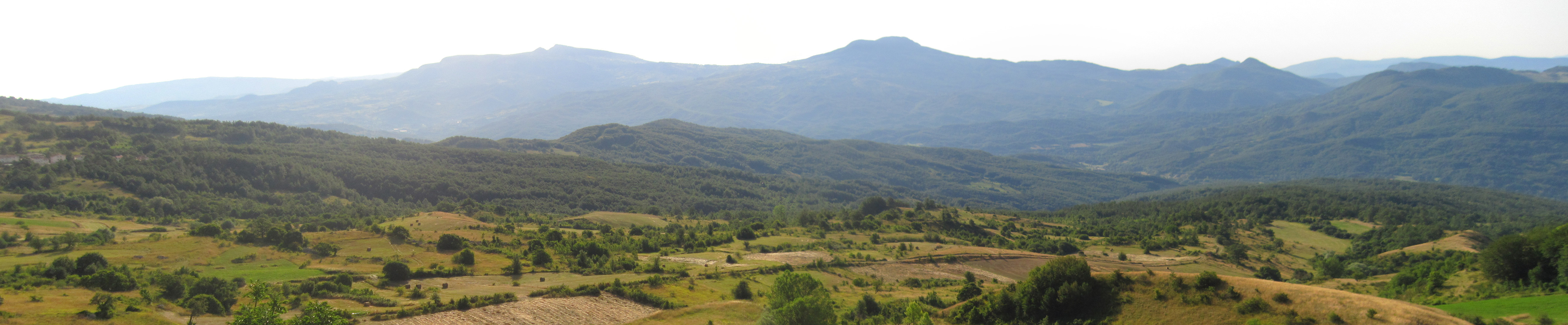
The climb in itself was not hard but with the heat, the lack of shade and wind and, above all, the flies that gave no respite it felt as if it were neverending. Fortunately, the effort was rewarded by the sight of the Sangro valley: what a view!
The village of San Pietro Avellana appeared at last and I was able to take a rest. There I met a nice guy, Pino, who was there on holiday. Meeting new people and feeling at ease with them right away is what I call "the backpack magic". I am always amazed to see how the presence of a backpack soon breaks down interpersonal barriers.
Having recovered my energy, I started my journey towards a small hotel located just outside the village. At the end of the day I was exhausted: I was supposed to walk about 20 km, and I covered 27 km instead! The acquired GPS track, once cleared of all the failed attempts, was about 22 km long: I had spent 5 km roaming about in search of a path!
 |
 |
Track of the day