")
")
")
")
                         |
| Click to enlarge |
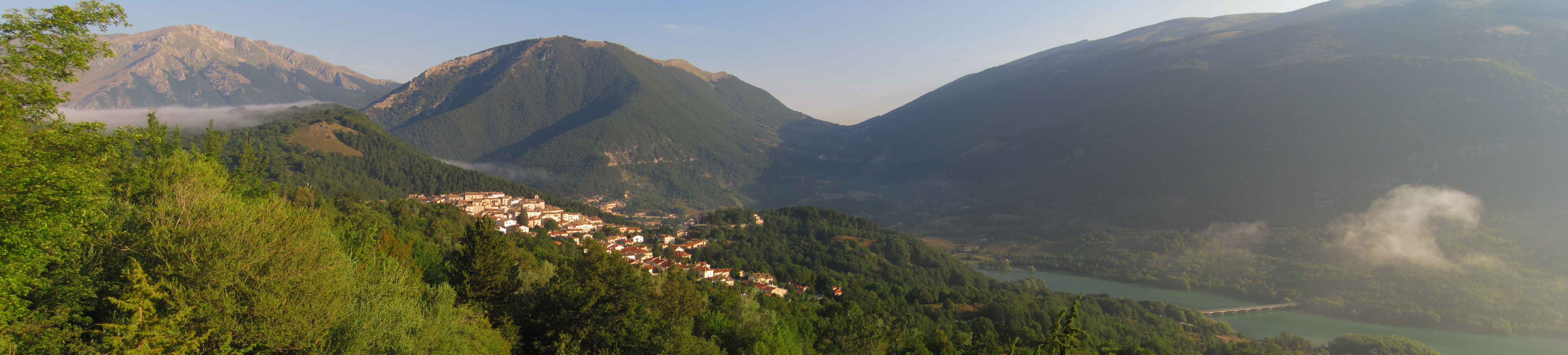
August 8th, 2018 - The sunshine on the second day immediately uplifts my mood. I have prepared two alternative routes for the today's stage, both of which avoid passing through the tratturo. The reason for this choice is because the tratturo ran along the valley floor, following the Sangro river exactly where Lake Barrea now stands. The enormous artificial lake was inaugurated in 1957, long after the transhumance had fallen into disuse. One of the paths I have prepared follows the lake on a comfortable track, while the other path stays at a higher elevation, by following the "Sentiero Italia" (SI).
I prefer the higher path as it offers breathtaking views. Initially, some minor landslides make me nervous, but as soon as I reach the top of the climb, the path widens and runs among the trees. The walk quickly turns into a pleasant stroll. Despite the early hour, there are already some people around. Every time the trees offer a glimpse of the lake, the views are dreamlike. I am satisfied with the choice I made.
The final part of the path has been affected by landslides, but the park authorities are already at work to restore it - if only it were always like this!
At the end of the path, the SS83 reappears. The tratturo passed through here, under the "Colle della Croce" pass. If I followed the road, I could reach Alfedena shortly, but I prefer not to walk on asphalt. Although rain is forecasted, there is not a single cloud in the sky at the moment. So, I descend towards Barrea to take the K1 trail of the CAI, which I saw on the hiking maps of the Abruzzo National Park. My GPS maps do not show it, so I hope the trail is well marked.
This choice also turns out to be fortunate. The route is beautiful, amidst a maze of dry stone walls. Fortunately, the signs are clear; otherwise, it would be easy to get lost. In the past, the entire area must have been intensely exploited for human activities, but now it is a kingdom of plants. The walk is a continuous alternation between open-air segments and tunnels among the plants.
As I congratulate myself, a tangle of plants blocks my path, requiring a chainsaw to clear. After some attempts, I finally find an alternative route and bypass the obstacle.
The forest opens up to a vast plateau, at the center of which lies an ancient watering font. The date of its creation, 1906, is inscribed on the front. Hoofprints suggest it is still used by livestock.
I take a moment to catch my breath before continuing, with only the final descent to the village left to conquer. However, the path, though clear on satellite, has become an impenetrable thicket of brambles. After a long search, during which I consider to take a long detour, luckily some animal tracks drive me to the path that leads to the "Aia della Forca" pass and on to a glimpse of Alfedena.
The descent is rough. The signage is old and faded, as it has been a while since it was last refreshed. Despite the temptation to follow the power poles, I make an effort to stick to the marked path.
After a long descent, I reach SS83, where it leaves the course of the tratturo and zigzags down towards Alfedena. I follow the tratturo to avoid the asphalt and come across some stations of an old Via Crucis and directions to the acropolis of Aufidena. However, impending rain forces me to hurry to reach the B&B.
Vittorio welcomes me with a much-needed bottle of cold water. By the time I reach the bedroom, it starts raining: this time I managed to escape it. Later, the village tour is marred by continuous downpours.
At day's end, I enjoy a chat and a shot of liquor with Vittorio and another guest, feeling satisfied with how the adventure has begun.
 |
 |
Track of the day